Sampling at the Exact Location
Visualizations are concepts only, not mechanical diagrams
One of the ways that ROGO delivers unparalleled accuracy in soil sampling is location.
What’s at Stake?
Let’s talk about what’s at stake. We all know that hot spots can exist in a field, and they can vary in size but they can be pretty small. So in a grid sampling scenario, if we sample outside the hot spot for several sampling iterations, then one of the sampling iterations we sample 30 feet in a different location, we can be inside that hotpot. That’s creating artificial noise.
In a Zone sampling scenario, we still have those same problems with hotspots, but we also have a second issue. Within that zone we could have significantly different levels of nutrients, so the number of cores we take in each zone has a big impact. That’s why many of our clients who are doing zone sampling are recording their core locations so they can repeat them year to year. How well you repeat those can have a big impact.
It all comes down to year-to-year repeatability, if we have one of those hot spots and create artificial variants, we could be making bad decisions on how we manage that area of the field.
What’s the Problem?
What are the problems that are causing this? Well, one is the GPS used. Some use RTK-level GPS, but many are using iPads. Even if they’re plugging auxiliary GPS into their iPad all, of this is “floating” or uncorrected GPS, which can range from 10 to 30 feet in accuracy. On top of that, we have the human error involved. Even when you’re trying to do a good job, if you’re running hard trying to get acres done and have a small screen, stopping at the exact right location can be difficult. In addition to that, you have then walking around the machine introducing more human error and hitting those cores accurately and repeatably.
ROGO’s Solution
ROGO solves this problem with RTK-level GPS accuracy. At one inch absolute accuracy, so we can repeat core locations several years down the road without a problem. This also enables high quality boundary recordings for our clients.
We also have AutoDrive, which not only steers but starts and stops the robot at exactly the right positions within 3 feet any time we’re trying to execute a core location.
Lastly, we all know that robots sometimes make the wrong decisions. So our operators can avoid obstacles and (if allowed by the client) they can also move sampling points if they’re in an undesired agronomic location – for example next to a Waterway or a field boundary. Then they can record the reason that was moved and then we can repeat that new point moving into the future.
All in all, this is how ROGO solves the location part of unparalleled accuracy in soil sampling.
ROGO Samples at the Exact Location Every Time
What's At Stake? The Integrity of Your Soil Maps
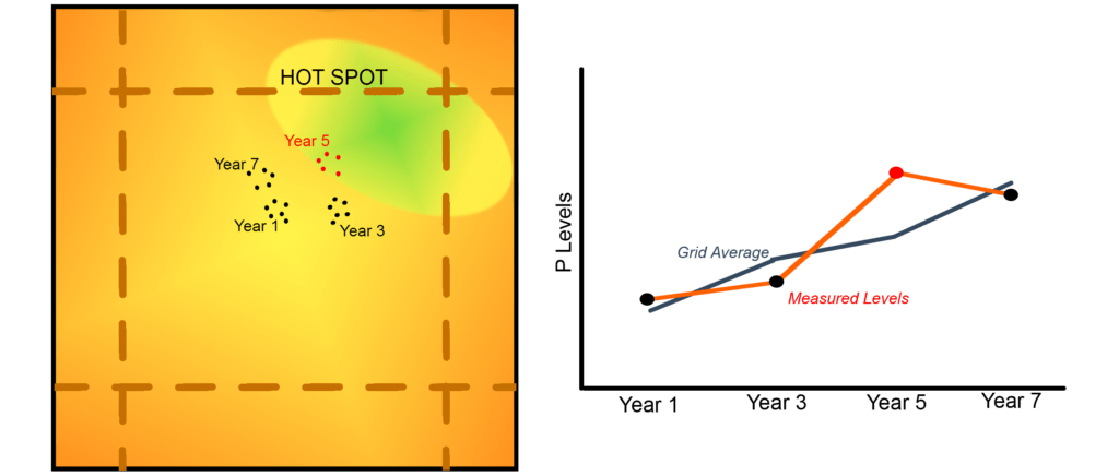
Grid or Zone Maps: Occasionally hitting hot spots (which are often small) can create confusing or misleading trends in your agronomic data.
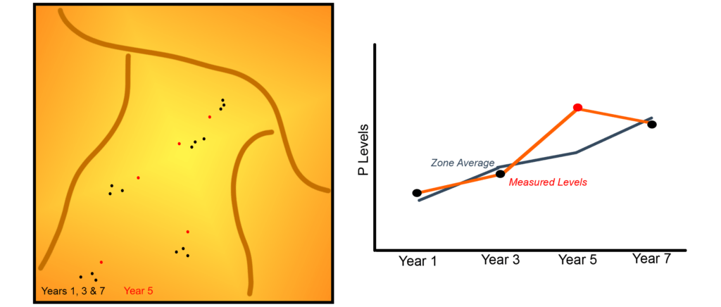
Zone Maps: Repeating core locations imprecisely (or not repeating them at all) can cause dramatic variations in nutrient measurements.
What's the Problem? Inaccurate Technology & Human Error
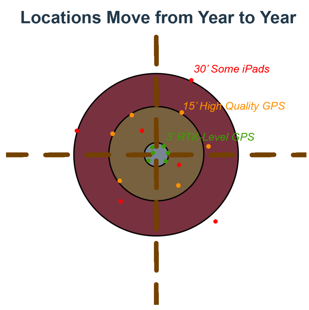
Inaccurate technology includes floating, uncorrected GPS systems like iPads and even an auxiliary GPS for an iPad.
Human error comes from stopping the vehicle imprecisely, or not properly distributing the cores at the sample site.
ROGO's Solution
Reduce meaningless noise in your data by sampling at the exact same location from year to year.